In the early 2000s, a company called Keyhole built a computer application superimposing satellite images & aerial photos to let the users zoom in & out of a detailed view of the Earth.
Google bought Keyhole in 2004; the same year, it bought a digital mapping startup, Where2 Technologies, and a company called ZipDash that provided real-time traffic analysis.
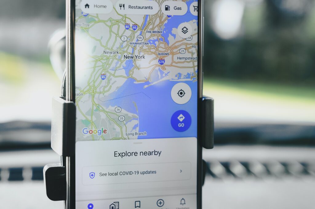
Combining these three technologies, Google launched Google Maps in Feb 2005.
In 2007, it added GPS (Global Positioning System) to the mix.
GPS is a technology that uses 30+ satellites to send and receive signals to/from our phones to determine the current location.
Now, Google is primarily a data company and so has access to reams of data collected from national and local government offices.
The roads’ data from these government offices tell Google where every road is and how lanes are spaced, etc.
But not all governments have data about all the roads and streets that could help Google provide an unbroken experience to the user.
And this is where Google Street View comes into play.
Street View is a Google program where Google collects millions of panoramic pictures using its special cars/cameras and from local contributors (here you can find where Google Car will be this month).
Google superimposes Street View data to its existing maps data (from various sources) to verify its existing data and join any broken pieces of information.
In a nutshell, Google Maps = Satellite phots (Keyhole) + Where2 Mapping Technology + ZipDash Traffic Analysis + GPS + Street View + Human Volunteers (they also correct errors, if any).
Now, to use Google Maps, millions of people give Google access to their real-time location data.
Some people have location data on, on their android devices, even when they are not using Google Maps.
With this vast amount of data, Google uses its supercomputers to analyse traffic, road conditions, and even the speed with which people are moving.
This is how we get live traffic information (blue = free-flowing traffic; orange = moderate traffic; red = heavy traffic).